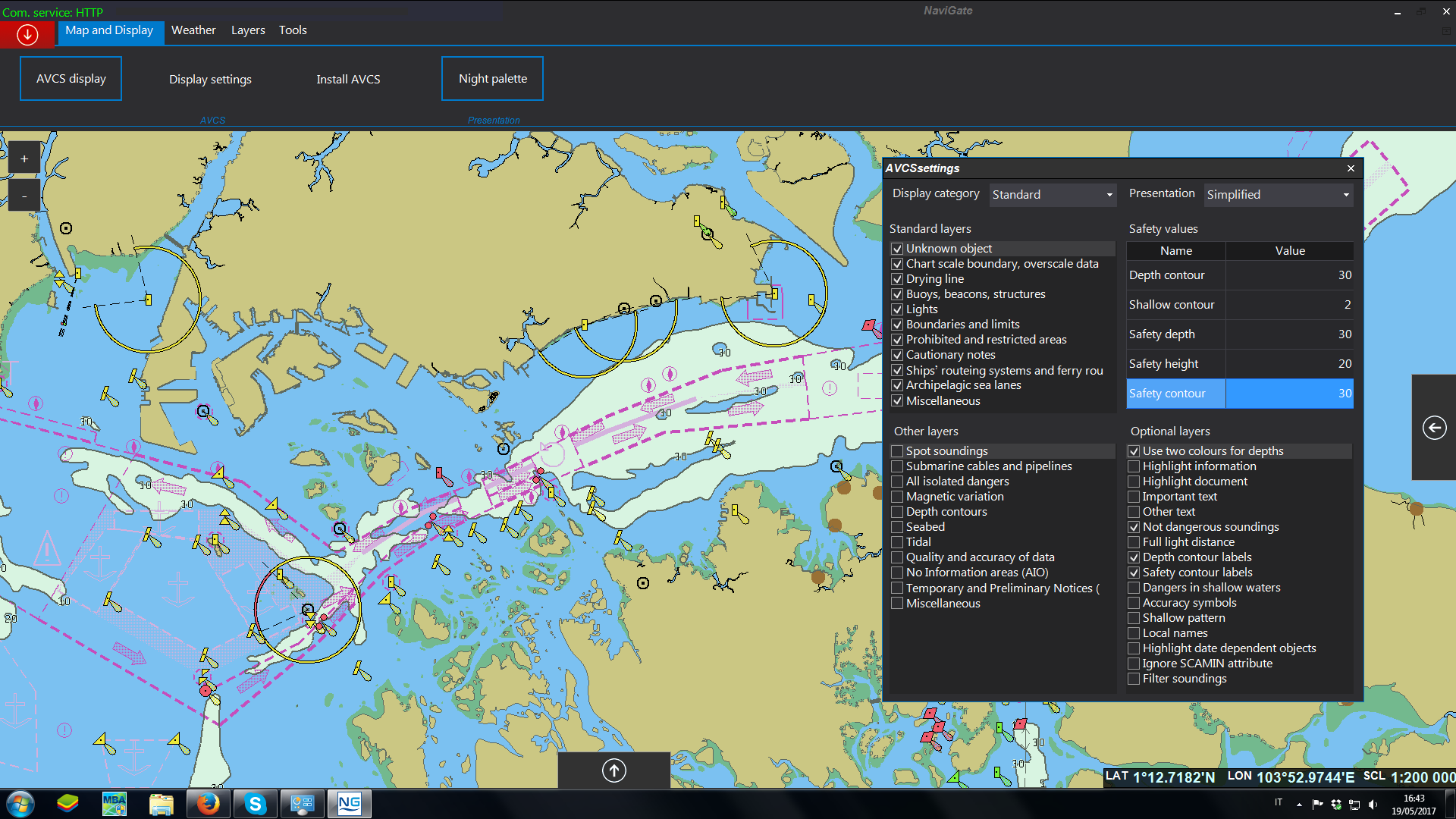
NaviGate is a tool to manage and display most of the required navigational data for a safe and compliant navigation.
NaviGate is UKHO Pay As You Sail Certified and is an UKHO Official Paper Charts and Publications Corrections Manager.
NaviGate Route Planner is a perfect complementary planning station to your ECDIS. Displaying all necessary data without cluttering the ECDIS screen, the navigator can plan his route according to ECDIS requirements and order all navigational data necessary for a safe and compliant voyage.
Built from our long experience in developing the CMS Outfit and Chart Management System and using latest software development technologies, NaviGate provides the navigator with a tool to manage and display most of the required navigational data for a safe and compliant navigation.
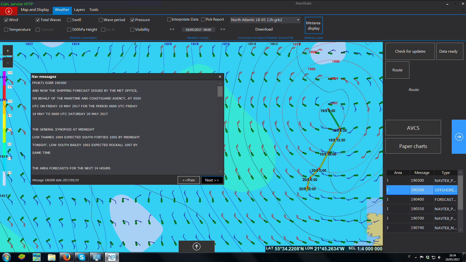
NaviGate provides full weather for all your needs in high quality data delivered by EPSON.
CAIM SOFTWARE
NaviGate
NaviGate is a tool to manage and display most of the required navigational data for a safe and compliant navigation.
NaviGate is
Its main features
Planning
NaviGate
Planning
MORE Outfit Management
NaviGate
Outfit Management
MORE Weather
NaviGate
Weather
MORE e-NP & ADP
NaviGate
e-NP & ADP
MORE Pay as You Sail
NaviGate
Pay as You Sail
MORE Route Optimization
NaviGate
Route Optimization
MORE MRV Reporting
NaviGate
MRV Reporting
MORE NavArea
NaviGate
NavArea
MORE NAVIGATE
Planning
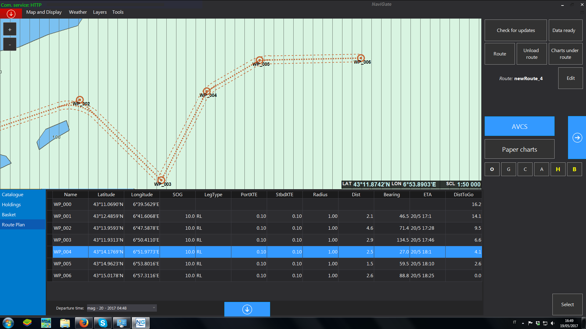
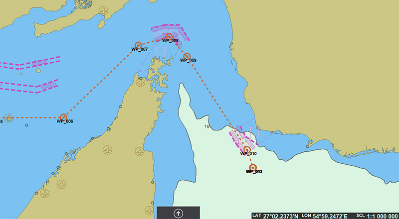
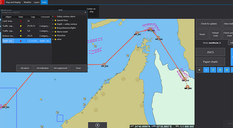
NaviGate Route Planner is a perfect complementary planning station to your ECDIS. Displaying all necessary data without cluttering the ECDIS screen, the navigator can plan his route according to ECDIS requirements and order all navigational data necessary for a safe and compliant voyage.
- Route Planning on UKHO Charts
- Overlay with AIO
- Route Checking and Dangers Highlighting along the Route
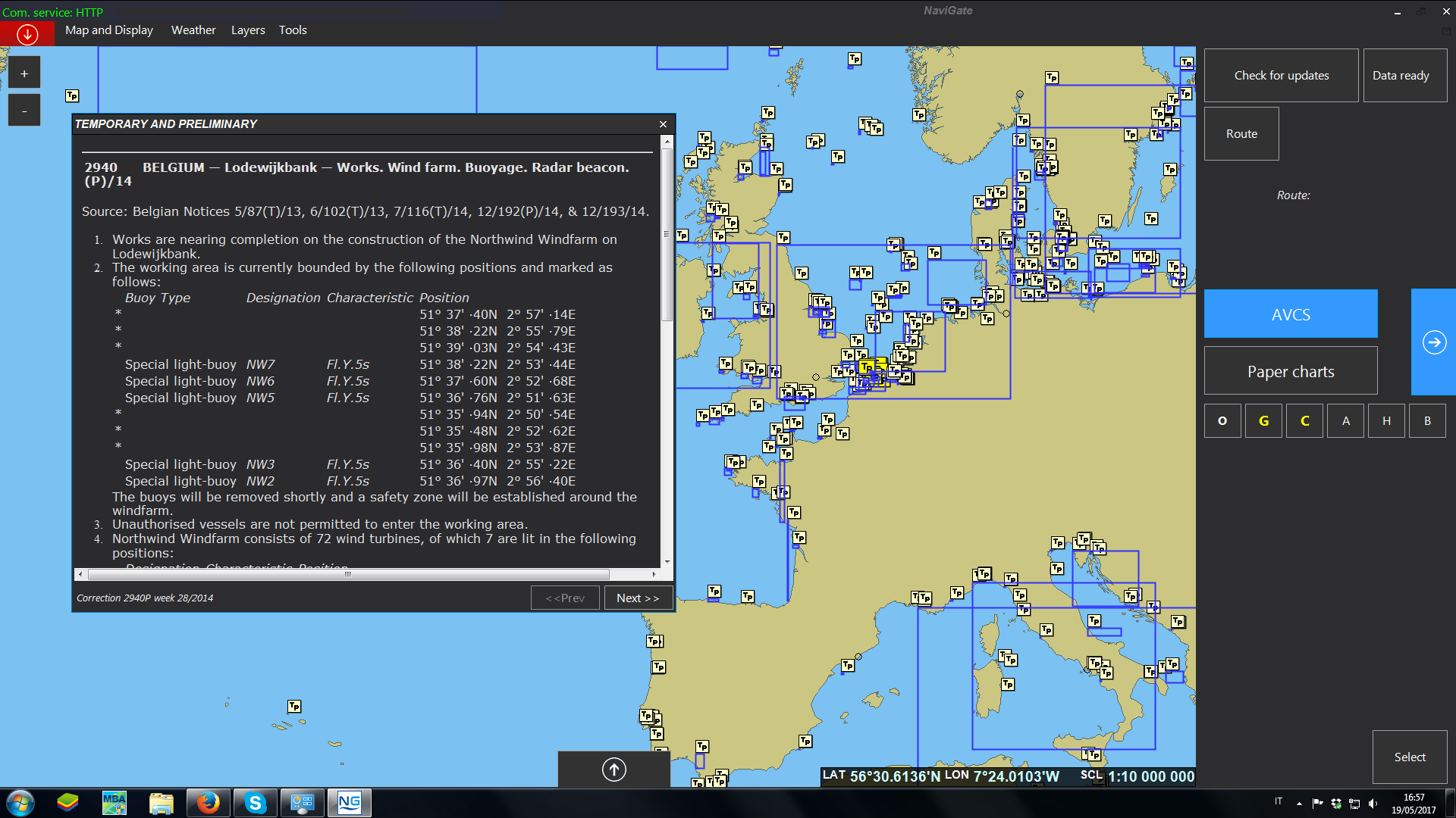
- T&P Layer built from weekly Paper Notice to Mariners
- T&P and Navarea Warnings related to the Voyage
- Charts and Publications under the Route
- Vessel Positions displayed on the Chart
NAVIGATE
Outfit Management
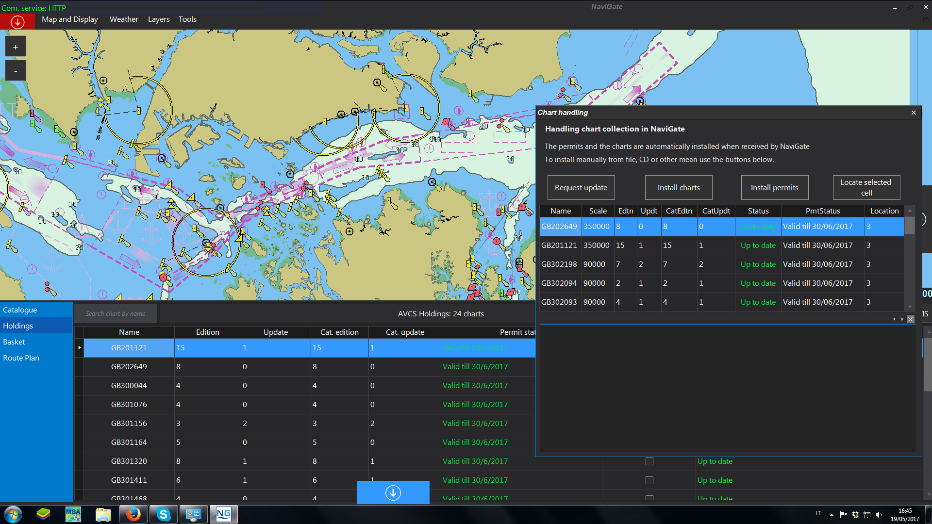
Built from our long experience in developing the CMS Outfit and Chart Management System and using latest software development technologies, NaviGate provides the navigator with a tool to manage and display most of the required navigational data for a safe and compliant navigation, including:
- On Board Chart
- On Board Outfit Management System
- UKHO Publication Corrections (Loose Leaf Service)
- Online Paper Charts Updating Module
- Technical Publications (TSO, IMO, OCIMF …)
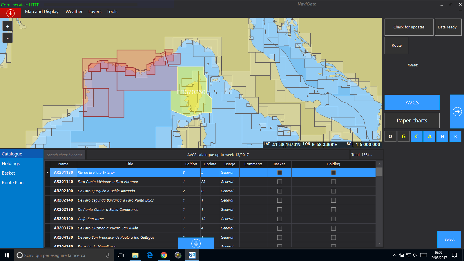
- Online AVCS Ordering and Updating Service
- UKHO Digital Publications Updates (ADP and e-NP)
- ISM Reports Module
NAVIGATE
Weather
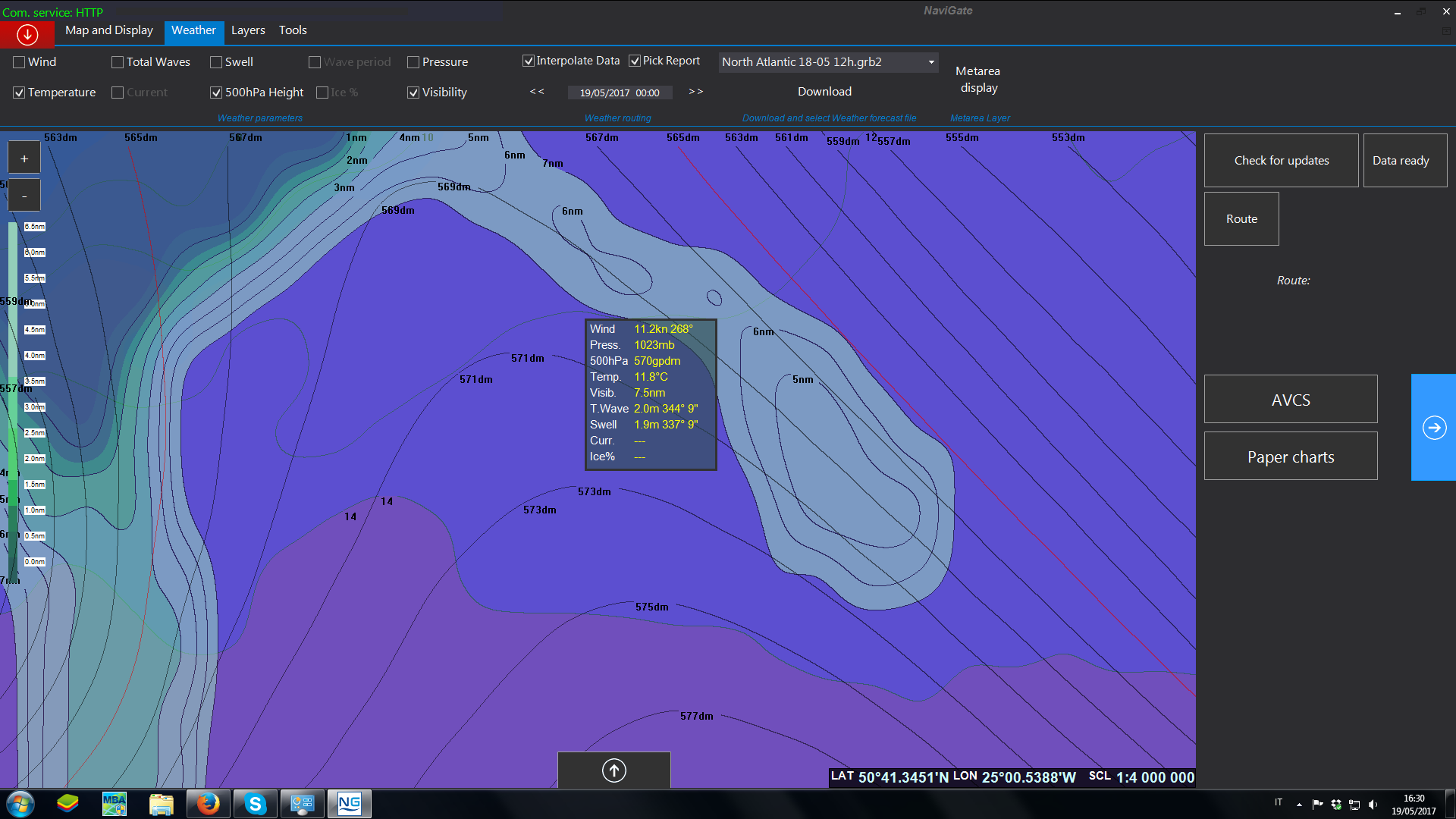
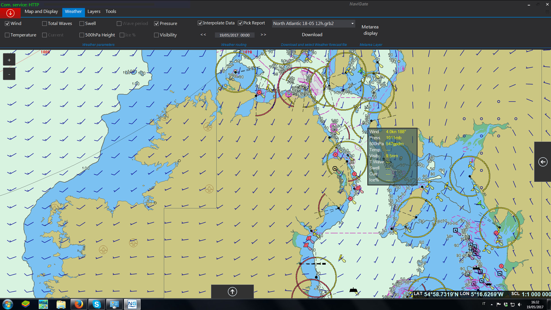
NaviGate provides full weather for all your needs in high quality data delivered by EPSON. You will get worldwide forecast for the following parameters:
- Wind (speed and direction)
- Total Waves (speed, direction and period)
- Swell (speed, direction and period)
- Pressure
- Sea Temperature
- Current (speed and direction)
- 500hPa Geopotential height
- Sea Ice
- Visibility
NaviGate also provides operational JCOMM official bulletins for each MetArea country, with most relevant forecast information useful for navigating officers in every day routines.
NAVIGATE
e-NP & ADP
Official Services
NAVIGATE
PAYS
Pay As You Sail
Pay As You Sail provides an effortless navigation for the mariners. The Master will be able to update the charts every week and he won’t need to do the charts activation anymore, it will all be automatic.
The PAYS system enables to view ALL the charts for planning, but only the charts where the vessel sails will be charged.
The vessel will be tracked and will be provided with a full AVCS PAYS FOLIO worldwide license, where all the charts of the world are included. These charts will be installed on NaviGate and the Master will have to select the geographical area they need, not to burden the ECDIS with too much data. Once the Master extracts the permits from NaviGate, using a USB stick, these permits will have to be installed onto the ECDIS, and the Master will be able to do the Passage Plan.
Once the voyage starts, only the charts on which the vessel actually sails will be licensed for 3 months and charged to the vessel, according to the satellite tracking.

NAVIGATE
MRV Reporting
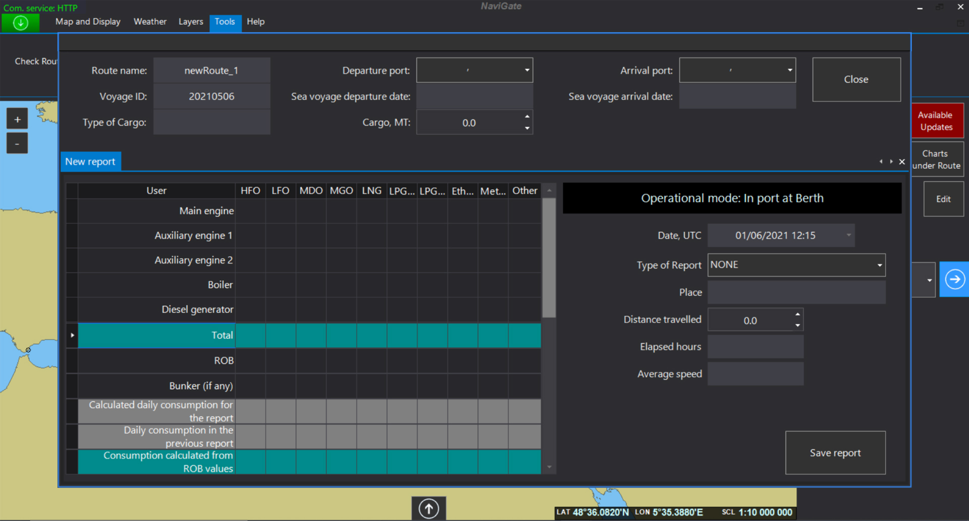
According to the EU Monitoring, Reporting and Verification of CO2 emissions regulations, all vessels with gross tonnage above 5,000 MT that are calling EU ports, must monitor and report the mileage and the fuel consumption. NaviGate MRV module simplifies the required data collection and produces a report in digital format compatible with the THETIS MRV Portal.
NAVIGATE
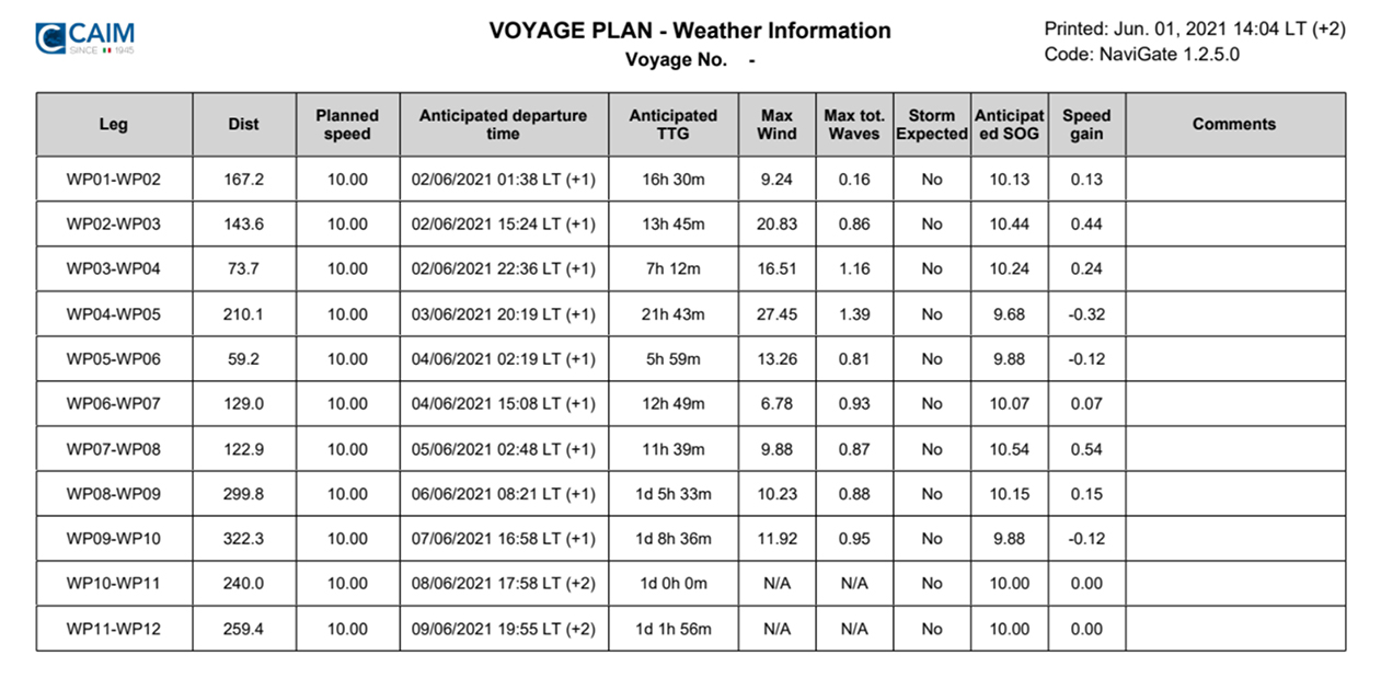
Voyage Planning
NaviGate Voyage Planning module is a great tool that assists the Captain during passage planning and produces a printable voyage plan in few minutes.
It takes in account:
- Minimum chartered depths and CATZOC corrections from official installed ENCs
- List of Dangers from official installed ENCs
- UKC, Airdraft and Squat calculations
- And much more…
NAVIGATE
NavArea
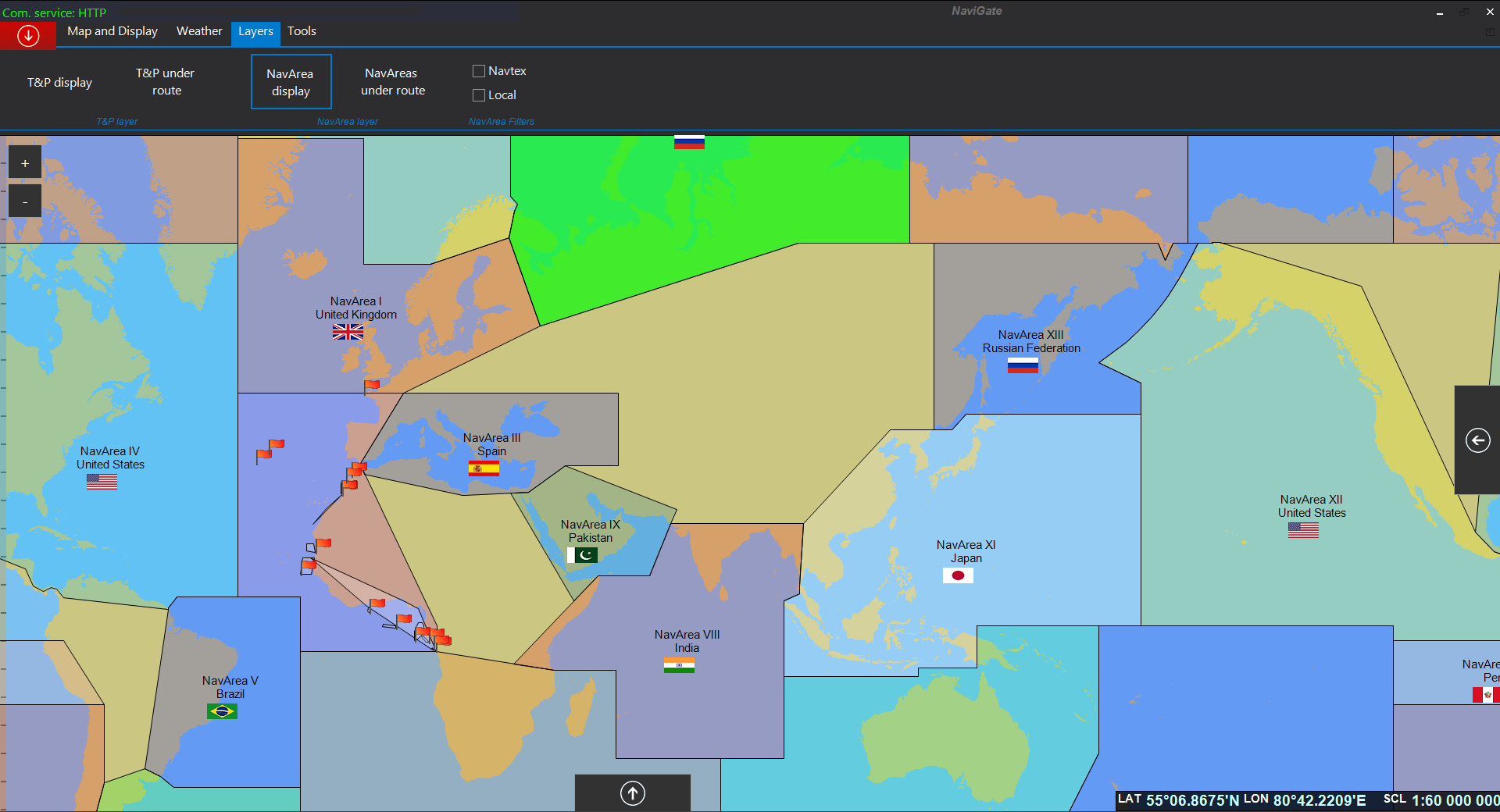
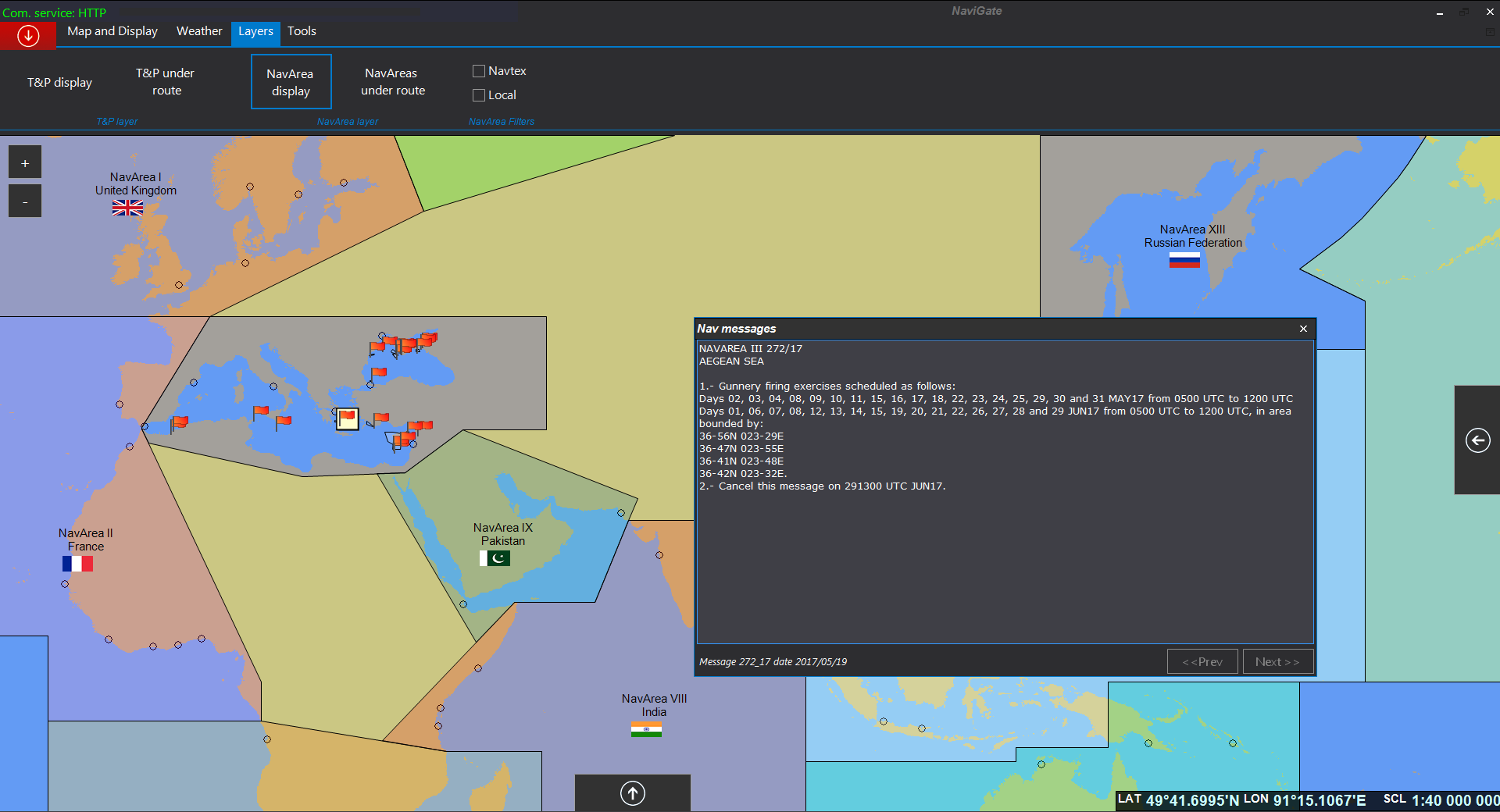
This feature allows the user to reduce his workload. All Navarea warnings are available through NaviGate, displayed in a user friendly interface. Geo-referenced warnings are displayed on the map and a whole collection of them is visible in a separate table.
The user can select them on map and check required information for the voyage.
CUSTOMERS
What they say about us
So far presently we are satisfy with implemented system.
NAVIGATE program is something we need all this years, as all necessary information for passage planning are in one place. I am glad to advise to go ahead and fully replace paper charts and publications with digital once.
This will simplify and accelerate the work in the future without unnecessarily consuming large amount of papers.
Save Paper, Save Trees, Save Space, Save Money.
Features like Weather, Nav-Area and Total Tide layers work fine. AVCS PAYS mode is working well when properly used, making the whole process much easier for all sides.
We think that coming time that any kind of paper charts/publication are not necessary, depend on Company decision.
In general, we found this system reliable and easy to use.
RECENT NEWS
Latest From The Sea

CAIM
Our Company
We ensure best service 24/7 and we are able to dispatch supplies to the world at short notice. CAIM has developped a full integrated, compliant and 100% customizable navigational Software, Navigate. With offices in Italy, Miami and Singapore, CAIM is leader in the market: one of the world’s largest International Chart Agents and sole agent for RINA publications (Registro Italiano Navale). It has been supplying the professional mariners in the SOLAS regulated nautical market since 1945. CAIM is a ISO 9001-2015 certified company.

Follonica
Venezia
Augusta
Latina
Valencia
Antwerp
Singapore
Miami

